

380 Armour Road, Suite 127
Peterborough, Ontario, Canada
K9H 7L7
Phone: (705) 745-1181
Fax: (705) 745-4163
Peterborough, Ontario, Canada
K9H 7L7
Phone: (705) 745-
Solutions for Today’s Environment
©Copyright 2014 Oakridge Environmental Limited, 380 Armour Road, Suite 127, Peterborough, Ontario, Canada, K9H 7L7
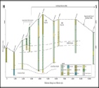
Geographic Information Systems (GIS) allow large
quantities of data to be managed in a database that is
linked to spatial (i.e., location) references. By simply
pointing and clicking on a map location, data about
that location can be retrieved, queried, sorted,
processed and analyzed. The stored information could
include population data, species descriptions, terrain
data and just about anything else that can be measured
or counted in the field. GIS is especially useful as an
intelligent mapping application for the management
of large amounts of data.
Oakridge Environmental Ltd. can customize a GIS
database for your project using your data and the
most up to date spatial (mapping) information. We
can also provide in-field collection of your data using
our mapping-grade global positioning system (GPS)
which can achieve sub-decimetre (i.e., +/- 10 cm) accuracy*.
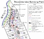
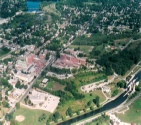
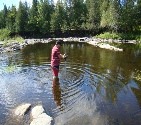
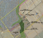
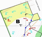
To see examples of how and where our mapping services have been utilized, please click on any of the
project links below:
*where conditions allow
quantities of data to be managed in a database that is
linked to spatial (i.e., location) references. By simply
pointing and clicking on a map location, data about
that location can be retrieved, queried, sorted,
processed and analyzed. The stored information could
include population data, species descriptions, terrain
data and just about anything else that can be measured
or counted in the field. GIS is especially useful as an
intelligent mapping application for the management
of large amounts of data.
Oakridge Environmental Ltd. can customize a GIS
database for your project using your data and the
most up to date spatial (mapping) information. We
can also provide in-
To see examples of how and where our mapping services have been utilized, please click on any of the
project links below:
*where conditions allow
Geographic Information System (GIS) Mapping
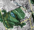
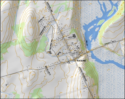
Data Source: Ministry of Natural Resources,
Copyright the Queen’s Printer (2010)
Copyright the Queen’s Printer (2010)